
Product Catalog
Browse by category or brand

 AGI · USA
SuperSting™ R1
The SuperSting™ R1 is a single-channel resistivity and induced polarisation (IP) meter used to scan and image the subsurface and to present the results graphically. It is a single-channel resistivity measuring and imaging instrument with Wi-Fi connectivity.

Arc-boat
The Arc-boat is a remotely operated hydrographic survey vessel manufactured by HR Wallingford, designed for river and channel surveys in conditions where a manned craft would be impractical or unsafe.

 SEBA Hydrometrie · Germany
SEBA KLL-Light
The SEBA KLL-Light is a portable electric water level meter for measuring water levels and total depth in boreholes, wells, and standpipes. An LED indicator and an audible buzzer are activated the moment the probe makes contact with water.
 SEBA Hydrometrie · Germany
SEBA KLL-Mini
The SEBA KLL-Mini is a compact, portable electric contact water level meter manufactured by SEBA Hydrometrie. It is designed to measure shallow groundwater levels and total depth in observation wells, boreholes, and narrow shafts from 1 inch in diameter.
 SEBA Hydrometrie · Germany
SEBA KLL-T
The SEBA KLL-T is a portable, battery-operated electronic depth gauge manufactured by SEBA Hydrometrie for the simultaneous measurement of water level and temperature in groundwater wells, boreholes, and observation pipes.
 SEBA Hydrometrie · Germany
SEBA Dipper-PT
The SEBA Dipper-PT is a high-performance 32-bit data logger and level sensor that records groundwater or surface water levels together with temperature. Manufactured by SEBA Hydrometrie, its compact, robust, and energy-efficient design suits hydrological, environmental, and irrigation applications.
 SEBA Hydrometrie · Germany
SEBA Dipper-PTEC
The SEBA Dipper-PTEC is a 32-bit data logger with an integrated subsurface probe, manufactured by SEBA Hydrometrie, for measuring water level, temperature, and electrical conductivity (EC) in groundwater and surface water.
 SEBA Hydrometrie · Germany
SEBA Dipper-APT
The SEBA Dipper-APT is a high-precision 32-bit groundwater data logger from SEBA Hydrometrie. Using absolute pressure and temperature sensors, it measures and records water levels and temperature automatically in wells and flood-prone areas.
 SEBA Hydrometrie · Germany
SEBA RG50
The SEBA Hydrometrie RG 50 is a compact, high-precision tipping-bucket rain gauge designed to measure rainfall and precipitation. It features a lightweight aluminium construction, pulse output, an optional 15 W heater for cold conditions, and straightforward connection to data loggers such as the SEBA Unilog.
 SEBA Hydrometrie · Germany
SEBA RG100
The SEBA RG 100 is a compact, high-precision tipping-bucket rain gauge manufactured by SEBA Hydrometrie. It combines a robust, lockable cast-aluminium protective housing with the funnel assembly in a single unit, designed for reliable, long-service meteorological and hydrological precipitation monitoring.

 HANNA Instruments · USA
Hanna HI9829
The Hanna HI9829 is a portable, waterproof multiparameter water quality meter designed to measure up to 14 or 15 key water parameters simultaneously, including pH, dissolved oxygen (DO), electrical conductivity (EC), turbidity, and temperature. It is well suited to field work in rivers, lakes, and coastal waters.
 HANNA Instruments · USA
Hanna HI98494
A portable, waterproof water quality meter capable of measuring up to 13 parameters. It offers Bluetooth data management from a mobile device, a dual battery system, and a probe with an easily configurable logging interval, making it suitable for both natural water bodies and industrial process monitoring.

 Freiberg Instruments · Germany
Freiberg lexsyg smart
The lexsyg smart from Freiberg Instruments is a compact, fully automated luminescence reader designed for routine measurement, retrospective dosimetry, materials research, and luminescence dating (TL/OSL/IRSL). It provides a 40-position sample changer, stability-controlled optical stimulation, and independent operation of the sample chamber.
 Freiberg Instruments · Germany
Freiberg lexsyg research
The lexsyg research system from Freiberg Instruments is a highly sensitive, modular luminescence reader designed for advanced research in thermoluminescence (TL) and optically stimulated luminescence (OSL), as well as for materials analysis, dating, and dosimetry applications.

 Stonex · Italy
Stonex S900+
The Stonex S900 series, including the Stonex S900+ GNSS receiver, comprises high-performance multi-constellation GNSS RTK receivers designed for professional land surveying. They acquire global satellite signals to deliver high-precision real-time positioning data in the field.

CZI CZ100
A high-performance, dependable medium-sized tethered emergency lighting system that integrates drone and illumination technology. Powered by a ground-based tethered supply, it provides robust support for night-time emergency and rescue operations.

CZI CZ10
The CZ10 is a lightweight, high-performance illumination unit designed for a wide range of operational scenarios. Connected to an external power supply or a vehicle power source, it provides sustained illumination over extended periods. The airborne and ground units together weigh only 3.5 kg, can be carried by a single operator, and are ready for use within three minutes of unpacking.

 Heron Instruments · Canada
Heron dipper-See EXAMINER
The Heron dipper-See EXAMINER is a portable downhole camera system for the visual inspection of wells and boreholes, supplied on a robust reel assembly for straightforward deployment and retrieval in the field.
 SEBA Hydrometrie · Germany
DischargeKeeper
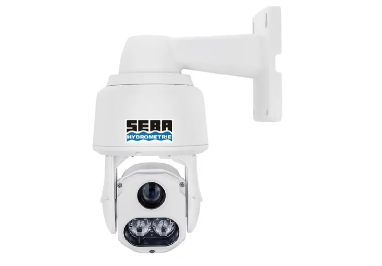
The DischargeKeeper is an image-based system for the continuous monitoring of flow velocity profiles, water levels and flow rates in natural water streams, irrigation furrows and waste water channels. The DischargeKeeper consists of an IP-camera, an infrared beamer, and a measuring transducer with remote data transmission.
 OSIL · UK
1.9m Metocean Buoy (Fulmar)
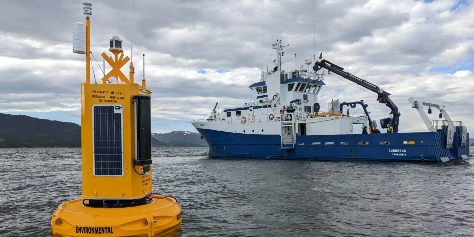
OSIL’s Fulmar Buoy is a versatile instrumentation platform ideally suited for collection and measurement of oceanographic, meteorological (metocean) and water quality data parameters in inshore coastal areas, as well as open water applications. Instrumentation can be deployed anywhere from near surface to the seabed. The data buoys can be moored in a fixed position with either single point, dual point or compliant mooring (where required). The system is supplied with a range of sensors that can specified by the customer (including CTD, DO, pH/ORP, Turbidity, Chlorophyll, Rhodamine, current speed/direction, wind speed/direction, temperature, humidity, pressure, rainfall, and solar radiation as well as a GPS locator). All buoys are fitted with solar panels, navigation/warning lights and other markings as necessary. A range of telemetry options are available (UHF/VHF, GSM, GPRS, Satellite), selected to suit both the location and application requirements. OSIL provide a complete data telemetry solution, including either desk top or web-based software packages to access the data. The buoys are 1.9 m in diameter, with a total buoyancy of 2000 kg, and have a reserve buoyancy of 1000 kg after fitting the equipment such as solar panels, battery packs and monitoring instrumentation, etc. The OSIL range of buoys are manufactured using rotationally moulded polyethylene hulls, which are foam filled for added security. The hulls are constructed around a galvanised steel or welded polyethylene central structure, which has a large hole through the centre which allows the passage of instrumentation and cables from the tower down through the water column to the seabed. By utilising a ‘Moon Pool’, instrumentation in the centre of the buoy is well protected from damage during deployment and operation.
 Nortek Group · Norway
Signature 500
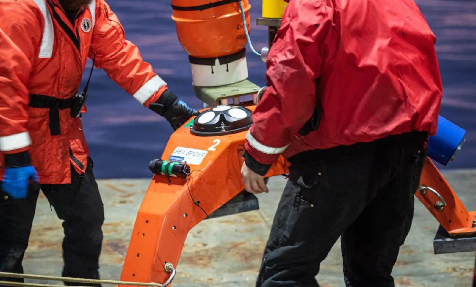
The Signature 500 ADCP is designed for flexibility. It measures current profiles at up to 8 Hz sampling frequency. It can also measure direct vertical velocity profiles, wave height and direction, and acoustic ranging to ice. The center beam also functions as a biological echosounder, enabling high-resolution measurements of biomass in the water column. All these features can be combined using Nortek’s patented concurrent mode technology.
 MAE advanced geophysics instruments · Italy
X824S
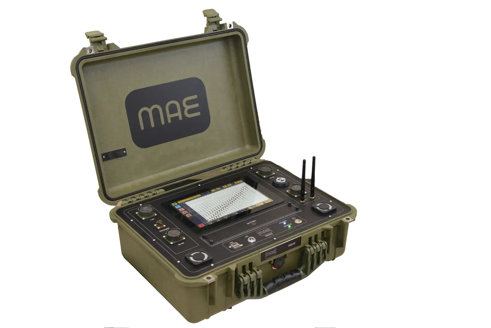
Sismografo dotato di 24 - 48 - 72 - 96 canali integrati per prospezione sismica attiva e passiva. X824S è dotato all’origine di 24 canali ed è configurabile con moduli di 24 canali, senza necessità di alcun box di espansione esterna, fino ad un massimo di 96 canali integrati a bordo della strumentazione. La strumentazione è dotata di PC di gestione con monitor da 10” integrato e sistema operativo Windows 10. La gestione di tutti i settaggi preparatori all’indagine da realizzare, impostazioni di acquisizione, l'esecuzione e la visualizzazione dei dati acquisiti vengono realizzate in sequenziale ed intuitivo per mezzo del sistema operativo installato a bordo della macchina, che comprende anche un tutorial con istruzioni passo passo per l'esecuzione delle metodologie maggiormente diffuse. L'elevata flessibilità unita all'elevato range dinamico, fanno di X824S la soluzione ideale per realizzare ogni tipologia di sondaggio sismico di tipo attivo o passivo fra cui: prospezioni sismiche superficiali come la sismica a rifrazione, riflessione (Onde P ed S), M.A.S.W. , Re.Mi. , E.S.A.C., quelle in foro come Down Hole e Cross Hole, fino a quelle di sismica passiva a stazione singola di tipo H.V.S.R. e di il monitoraggio vibrazionale. Con particolare riferimento alle metodologie di indagine sismica, il modulo di 24 canali consente l’adozione di un unico cavo con 24 prese, che insieme al pacco batterie integrato, contribuisce a diminuire il numero di accessori necessari alle indagini da dover portare con sé ad ogni sondaggio.
 R2SONIC · USA
Sonic® 2026-V
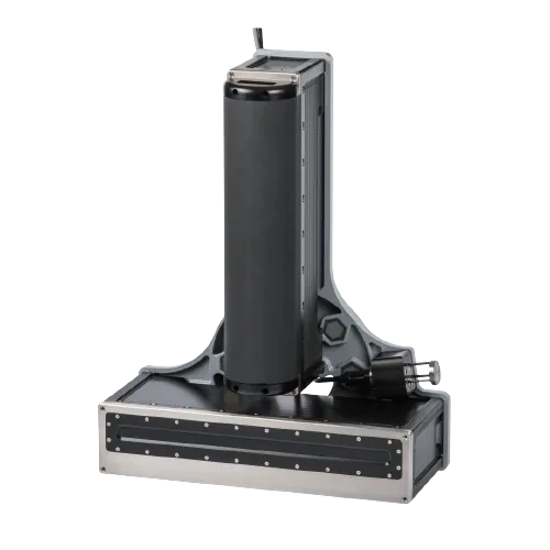
Multibeam Echosounder Ideal for advanced hydrography, research & seafloor characterization, on surface vessels, ROV or AUV
 CHELONIA Limited · UK
F-PODs
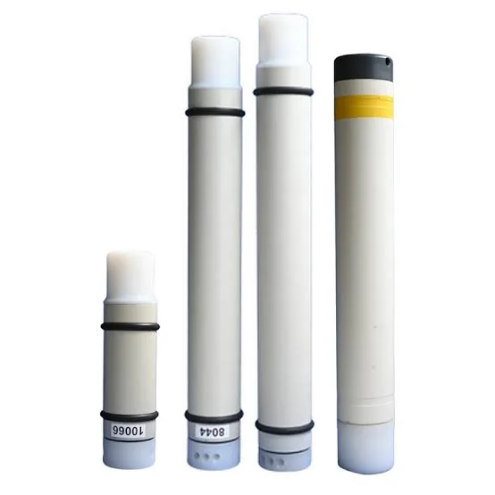
F-PODs detect all odontocetes – toothed cetaceans – except the Sperm Whale. This is a Boto (Inia geofrennsis) in the Amazon It would be very useful to be able to distinguish it from the Tucuxi (Sotalia fluviatilis) At present, the KERNO-F classifier places trains in ‘NBHF’ (porpoise-like narrow band high frequency clicks), ‘Other cetaceans’, ‘Boat sonars’ or ‘Unclassed’. Work is proceeding on how to distinguish species in many places where it would be useful. The information produced by the F-POD on where clicks are within trains and where trains are within encounters is very significant for this.
 Geometrics · USA
StrataVisor NZXP
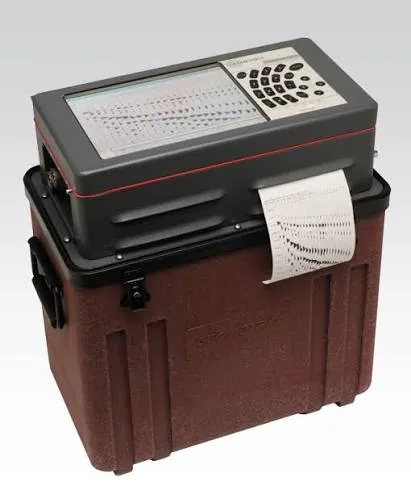
For those practitioners who prefer not to use laptops in the field, the feature-packed StrataVisor NZXP is an “all-in-one” seismograph housed in a compact, weatherproof and shockproof chassis. In addition to a built-in PC, it includes a brilliant daylight-visible color screen, waterproof keypad and built-in printer. The StrataVisor NZXP is ideal for those practitioners who prefer the suitcase-style form factor for smaller surveys but wish to maintain Geode-like flexibility and performance. The NZXP comes with our MGOS acquisition package, which includes all of the necessary tools to conduct refraction, reflection, and surface wave surveys, including CDP roll-along, real-time correlation, and auto-triggering. Optional packages for marine surveying, continuous recording, GPS synchronization, and seismic surveillance are available. Containing up to 64 channels internally, the StrataVisor can be seamlessly expanded by adding Geode modules. And when we say seamlessly, we mean it: just plug in the Geodes and turn on the StrataVisor; configuration is automatic.
 GeoVista · UK
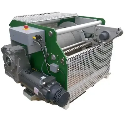
GV500 series
The GV500 series are reliable, heavy duty logging winches with a range of motor powers and cable capacities. These reliable, utilitarian winches are trusted by clients worldwide and have been manufactured for almost 30 years. A proven, heavy-duty design, engineered for safe operation, with reliable performance in demanding field environments - wherever you are.
 Aquarian Hydrophones · USA
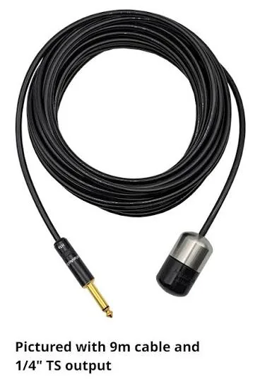
H1a Hydrophone
The H1 delivers high-quality audio performance in our most durable design. It is intended for use with high-impedance microphone or instrument preamps, such as the Honeytone. The H1a provides very good sensitivity and low noise across the human auditory range. Its streamlined shape and high specific gravity help maintain a stable working depth in moving water. A compact form factor and flexible cable make it highly portable and easy to use.
 Maritime Survey Australia · Australia
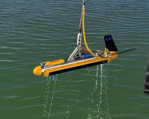
Remus 100
Maritime Survey Australia completed an NSCV Gap Analysis review for the operation of the AMC Search Remus 100, an Autonomous Underwater Vehicle (AUV). As the National Standard for Commercial Vessels (NSCV) does not cover Autonomous Underwater Vehicles, the NSCV Gap Analysis review was used to apply to AMSA for a Specific Exemption from the requirement for the Remus 100 to be issued with a Certificate of Survey and Certificate of Operation. This has now been issued by AMSA permitting AMC Search to operate the AUV as a commercial vessel. This is emerging technology which the NSCV has not yet caught up with however through the review and engagement between MSA and AMC Search we were able to present an outcome that was accepted by AMSA. Autonomous Underwater Vehicles are used to perform tasks including making charts of the seabed, and collecting seawater information and other data related to the undersea environment. The REMUS 100 AUV is a compact AUV which contains sophisticated sensors, and navigation and power resources enabling it to perform intricate sonar and oceanographic surveys over large areas.